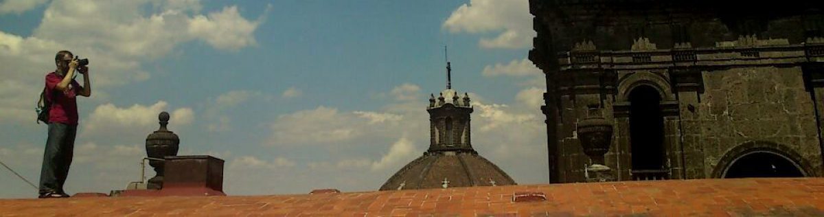
For this hiking-related entry, I decided to write about an epic, multi-day hike across the spine – or “backbone” – of the mountain range in which I have spent the most time. During the twelve years I lived in Los Angeles, I spent many a weekend day exploring LA and Ventura Counties’ literally hundreds of hiking trails. Three transverse mountain ranges pass through LA, and my favorite trails to hike are in the Santa Monica Mountains. These mountains follow the coast (more east-west than north-south in SoCal), cross the 405 Freeway to comprise the Hollywood Hills, and end at Griffith Park, one of the world’s largest urban green spaces.
The Backbone Trail is a 65-mile hike that takes you from the highlands of star-studded Pacific Palisades, into the hills above Malibu and the canyons beyond, ending at Point Mugu State Park in Ventura County. Along the way, the trail ascends and descends over 11,000 vertical feet, passing through five Mediterranean ecosystems and past geological and cultural treasures. The trail passes two Inspiration Points, at least two split rocks, and is a short scramble from the highest point in the range. Best of all? The highest point is just 3,111 feet above sea level, so cold weather is seldom much of a factor. This is one trail that is actually better when hiking during the fall-winter-spring off-season than during the scorching summer months. Are you ready to give it a try?
The Hike
Logistics: I have done the hike several times. I prefer hiking in an east-west direction, with the sun on your back in the morning and in front of you, sunset-like, in the later hours of the day. Thru-hiking is currently impossible without using a car shuttle or group campgrounds, as single-person or couples campgrounds are not currently open along the trail, with a single exception. Group campgrounds must be reserved in advance. ReserveAmerica is a good place to research current camping rates, rules, and reservations.
With a car shuttle, you can complete the hike in five long days. I did it as a long series of out-and-back hikes over many weekends. The Backbone Trail passes through private, city, county, state, and national land, so the rules about parking fees and horse-versus-mountain bike-versus-hiking are not hard and fast. Expect to pay between $5 and $14/day to park and you should be covered.
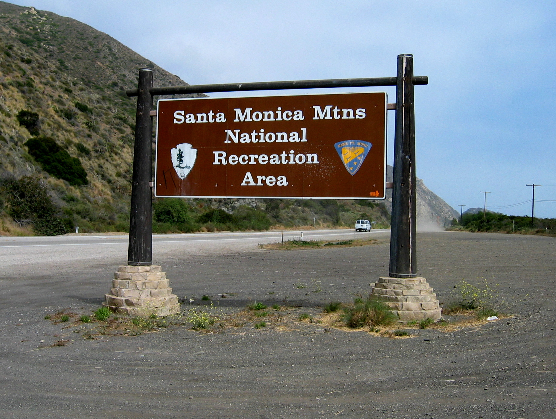
Cell phone reception is spotty on remote ridges and non-existent in the canyons, so be sure to pack a first-aid kit, windbreaker, hat, sunscreen, trail food, flashlight or head lamp, and water. Lots of water. Know how to recognize poison oak and be alert for rattlesnakes. Lastly, do not rely solely on this blog entry before setting off. The Santa Monica Mountains National Recreation Area (SMMNRA) has an excellent website. Click here for their map of the Backbone Trail.

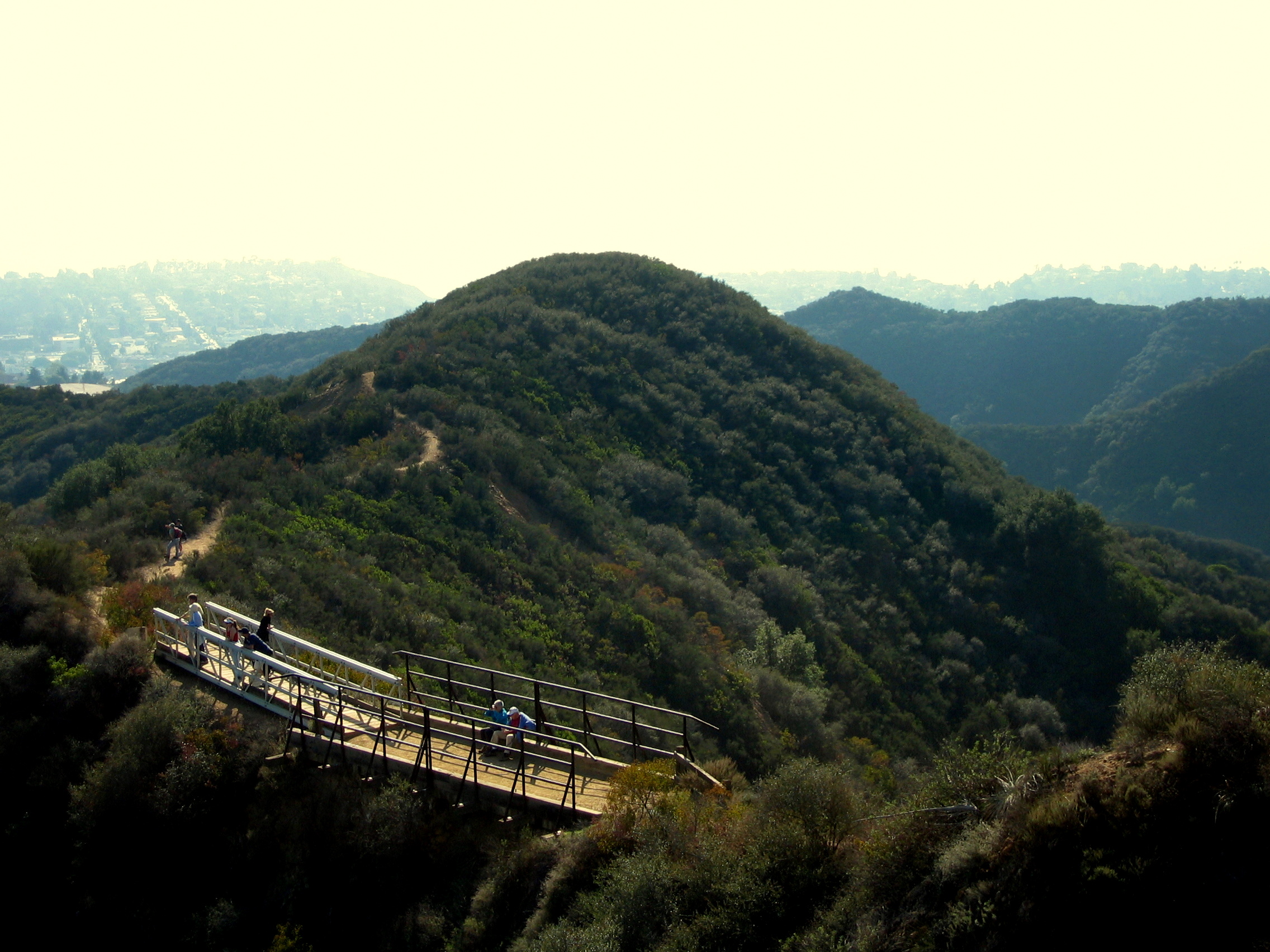
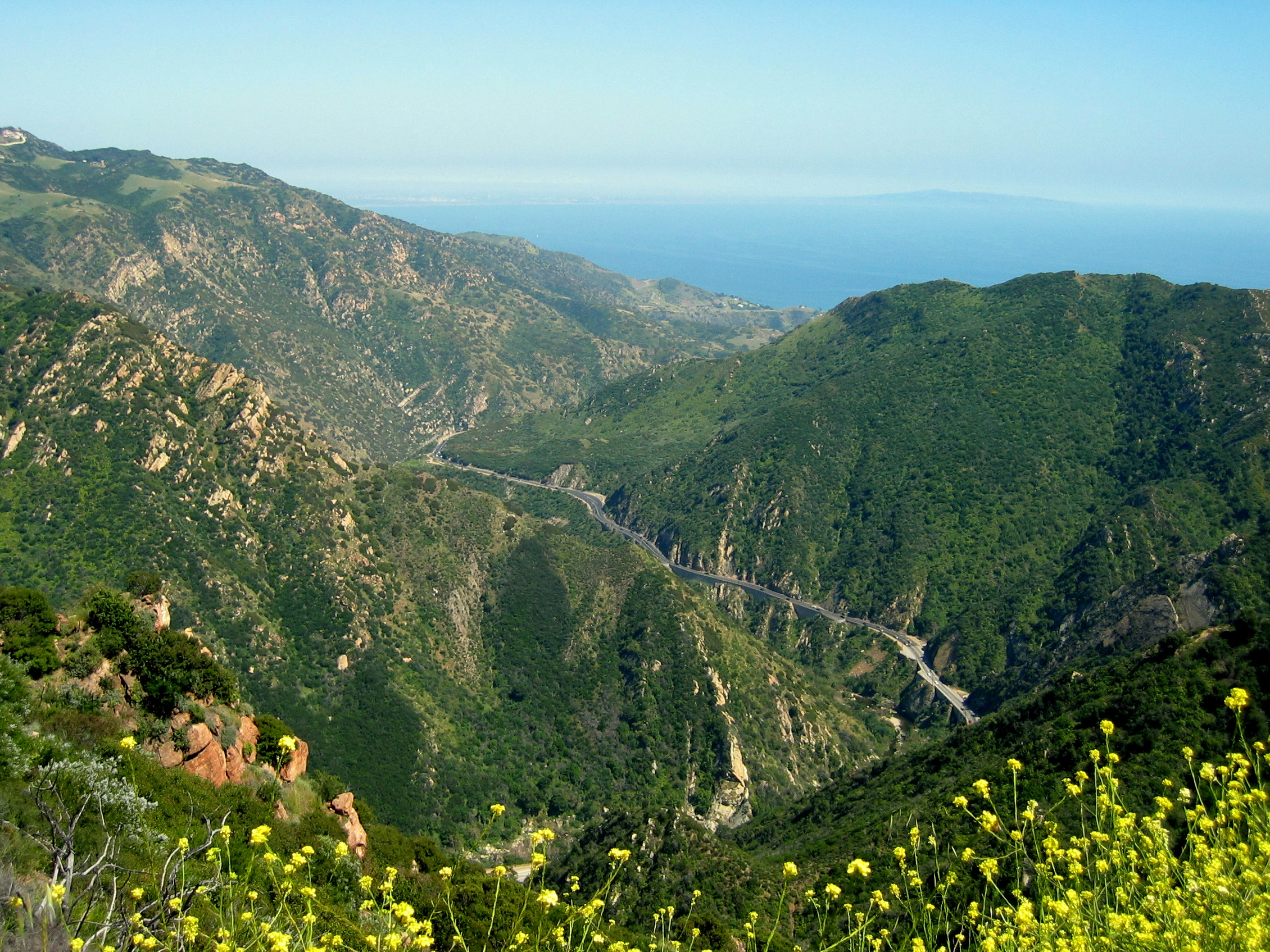
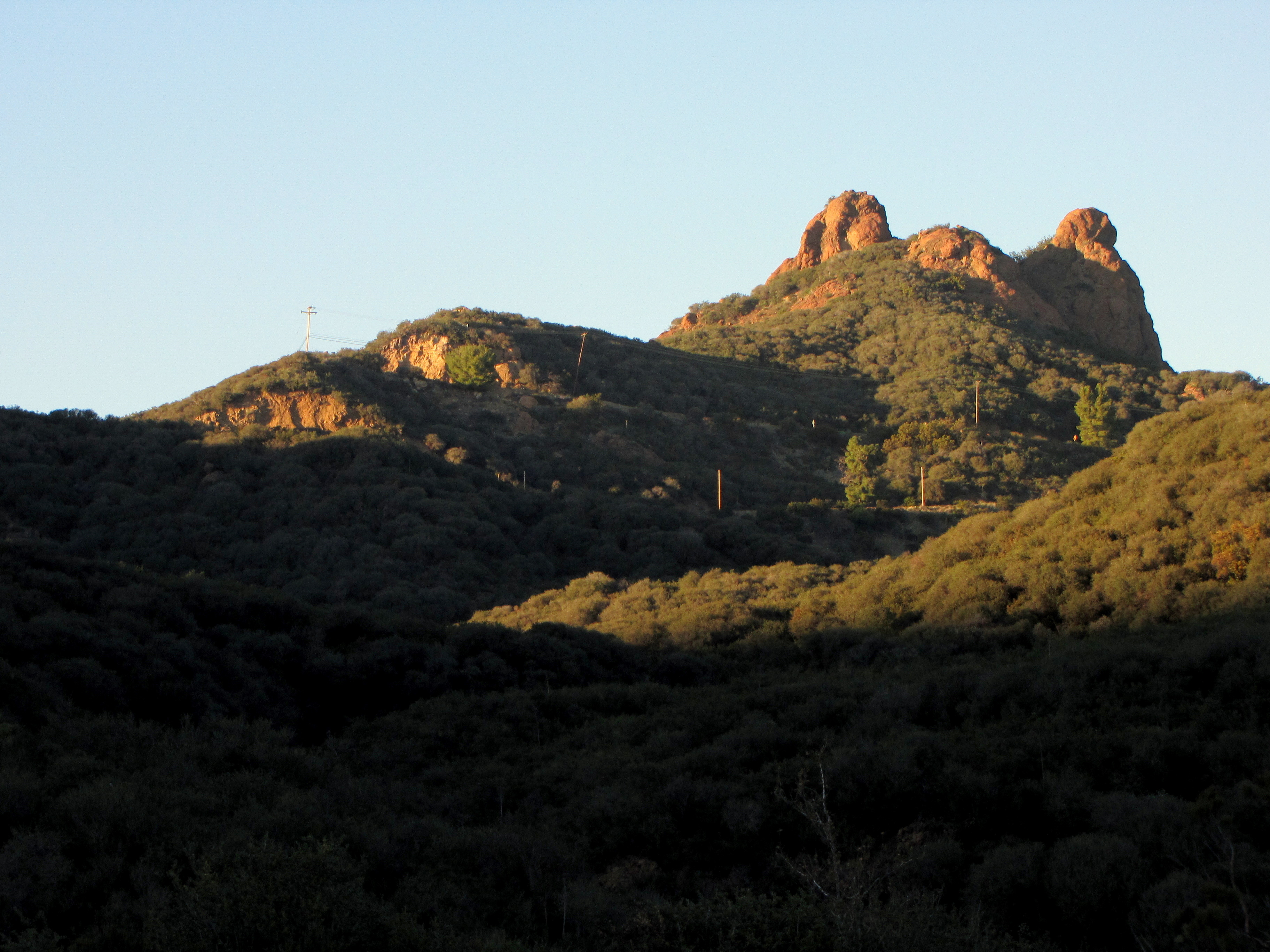
Day One: The adventure begins at Will Rogers State Historic Park, near Sunset Boulevard in Pacific Palisades. Here, behind the silver screen cowboy’s ranch home, the Inspiration Point Trail marks the start of what will surely be a hike to remember. Inspiration Point is a clearing at the high point of a gently-rising, two-mile loop that is popular with joggers and families. The Backbone Trail itself splits off the loop trail after one mile, and climbs in earnest. Pause for a moment at slightly-scary Chicken Ridge Bridge and enjoy the view. June Gloom notwithstanding, you can look out over Pacific Palisades, Palos Verdes Peninsula, and the Santa Monica Bay, all the way to Catalina Island.
The ocean view soon disappears as you enter a rural stretch of trail. Watch for mountain bikers on this singletrack. A lone oak tree (you can’t miss it) makes a good lunch spot as Upper Rustic Canyon comes into view to the north. The trail turns northwest and passes through intermittent shade as it follows Rogers Ridge for almost five miles to Temescal Ridge Fire Road and Cathedral Rock. Hub Junction is denoted by an information board where two westward-leading branches of the Backbone Trail meet the Temescal Ridge Fire Road section. You can continue west via Eagle Spring (downhill and then up) or Eagle Rock (uphill and then down). Which route you choose depends on whether you want to see Eagle Rock from up close and above or from afar and below.
The two branches meet again and you continue onto a narrow, bicycles-prohibited stretch near Musch Ranch. You are in the heart of Topanga State Park as you pass a small, fee-based walk-in campground (at time of writing, the only such campground along the trail). Lush Ceanothus lilacs line the trail as it nears Trippet Ranch, the Topanga State Park headquarters. This is a great place to refill your water for the last 1.1 miles of the day, which is mostly downhill and ends at the Dead Horse Trail parking area just off of busy Topanga Canyon Road. Total distance: 11.2 miles.
Day Two: From the Dead Horse Trail parking area, the trail begins just behind the restrooms. A narrow, S-shaped patch of green, it descends quickly to Topanga Canyon Road. Carefully cross the road and look for Greenleaf Canyon Road. Pick up the trail on the south side of the road. There are some route-finding challenges here, but climbing should be minimal, and if you’re successful you’ll pass a pair of water tanks and come out at the shoulder of Old Topanga Canyon Road. Cross here.
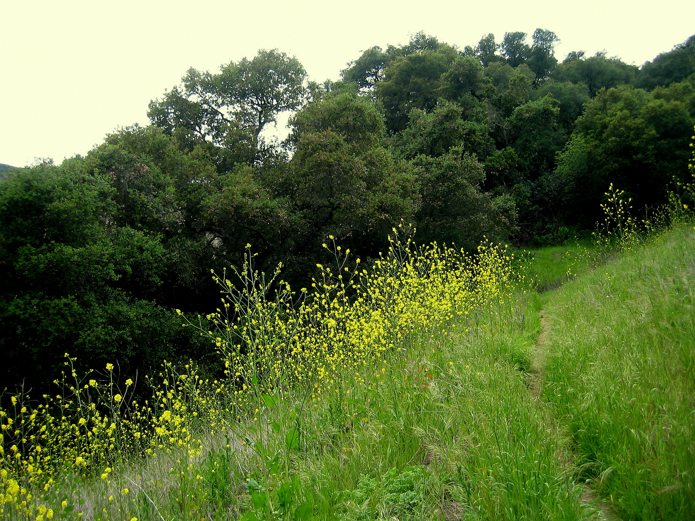
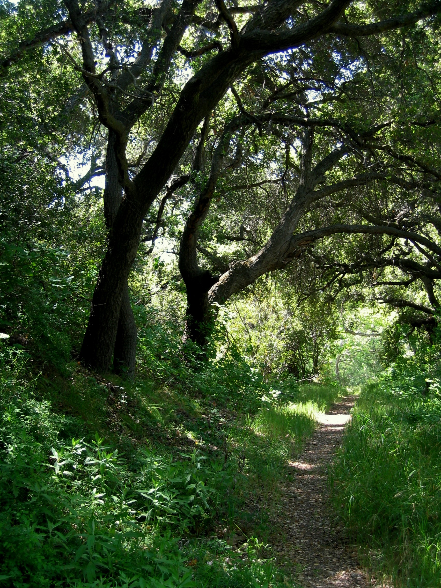
A marker denotes the continuation of the trail, which crosses a small creek (more of a brook, really) and then enters a peaceful meadow that is filled with lovely yellow deerweed flowers during the spring months. (In summer and fall, the flowers die and the “green” grass becomes a drought-plagued brown, but it’s still peaceful.) The trail climbs as Hondo Canyon forms on your right. A thick canopy of chaparral, laurel sumac, and – yes – poison oak provides shade for almost the entirety of your climb out of the canyon. It can be a long slog, but the mild grade makes it manageable. Mountain bikes are not allowed here but horses are; I wouldn’t want to be astride a horse on this section of trail, continually getting thwacked in the face by overhanging brush. Be sure to thank any volunteer trail crews that you may pass along the way.
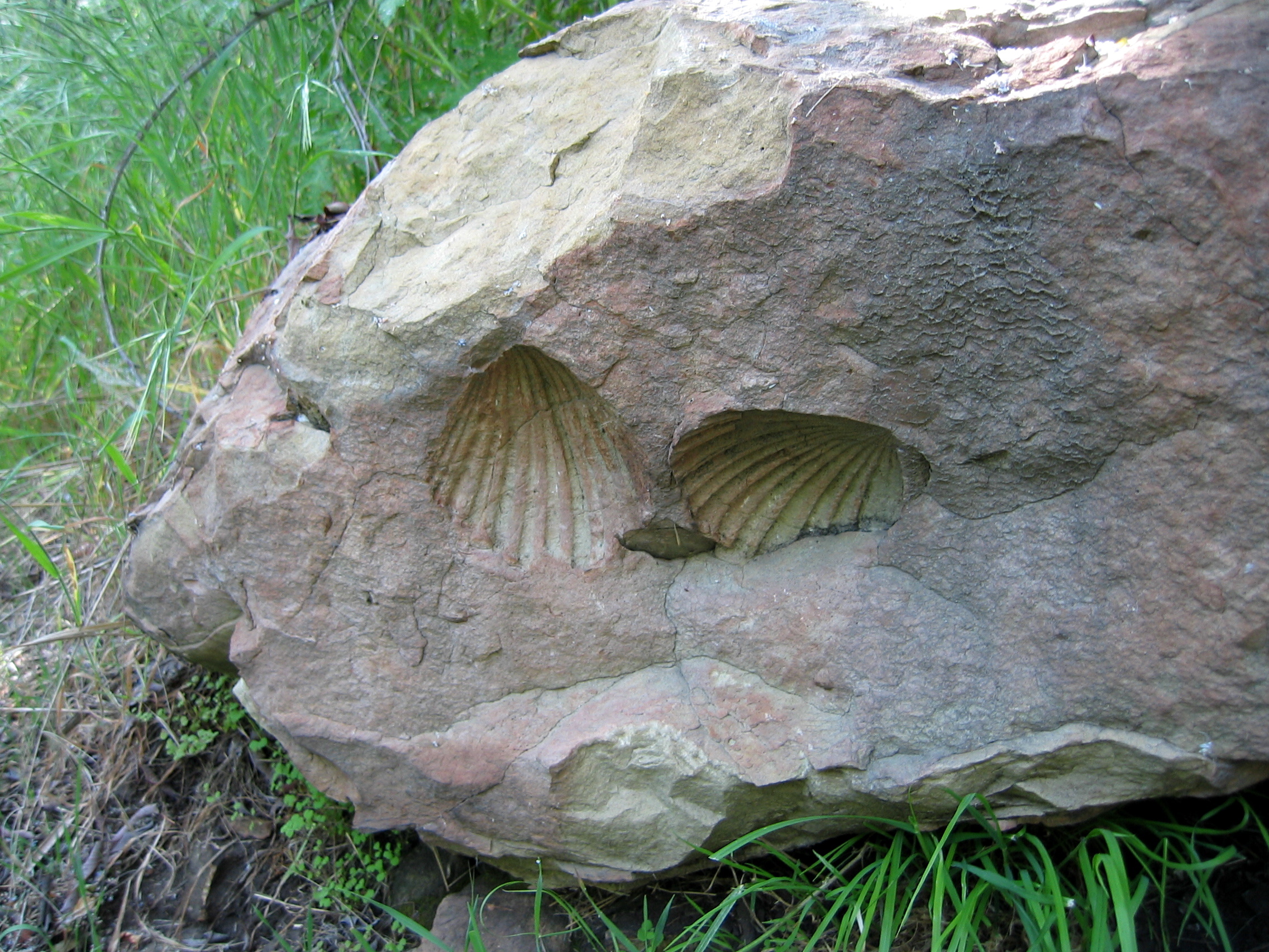
You’ll notice a microwave tower looming ever closer. The Hondo Canyon stretch of trail eventually deposits you at Saddle Road, but you still have a considerable distance to hike. The Fossil Trail is the trail’s continuation. It is an easy and unremarkable hike – except for a stretch of trail that passes a series of marine fossils, embedded into rocks and geological leftovers from when sea level was over 2,000 feet higher than it is today! Saddle Peak Road gets its name from the highest peak in the area – 2,805-foot Saddle Peak. You can see it ahead of you and guess what? That is your next destination!
Cross the three-way intersection and carefully walk along the left shoulder of Stunt Road for perhaps 100 yards. The Backbone Trail starts up again, climbing past the foundations of a ruined house, past another water tank, and to its highest point of the hike so far. A short spur trail leads to Saddle Peak East, while slightly-higher Saddle Peak West is marked by an impressive antennae array. I have been here when the entire Eastern summit was covered in view-obscuring chaparral. I have also been here not long after NPS trail maintenance, when nothing blocked the view, which extended for miles.

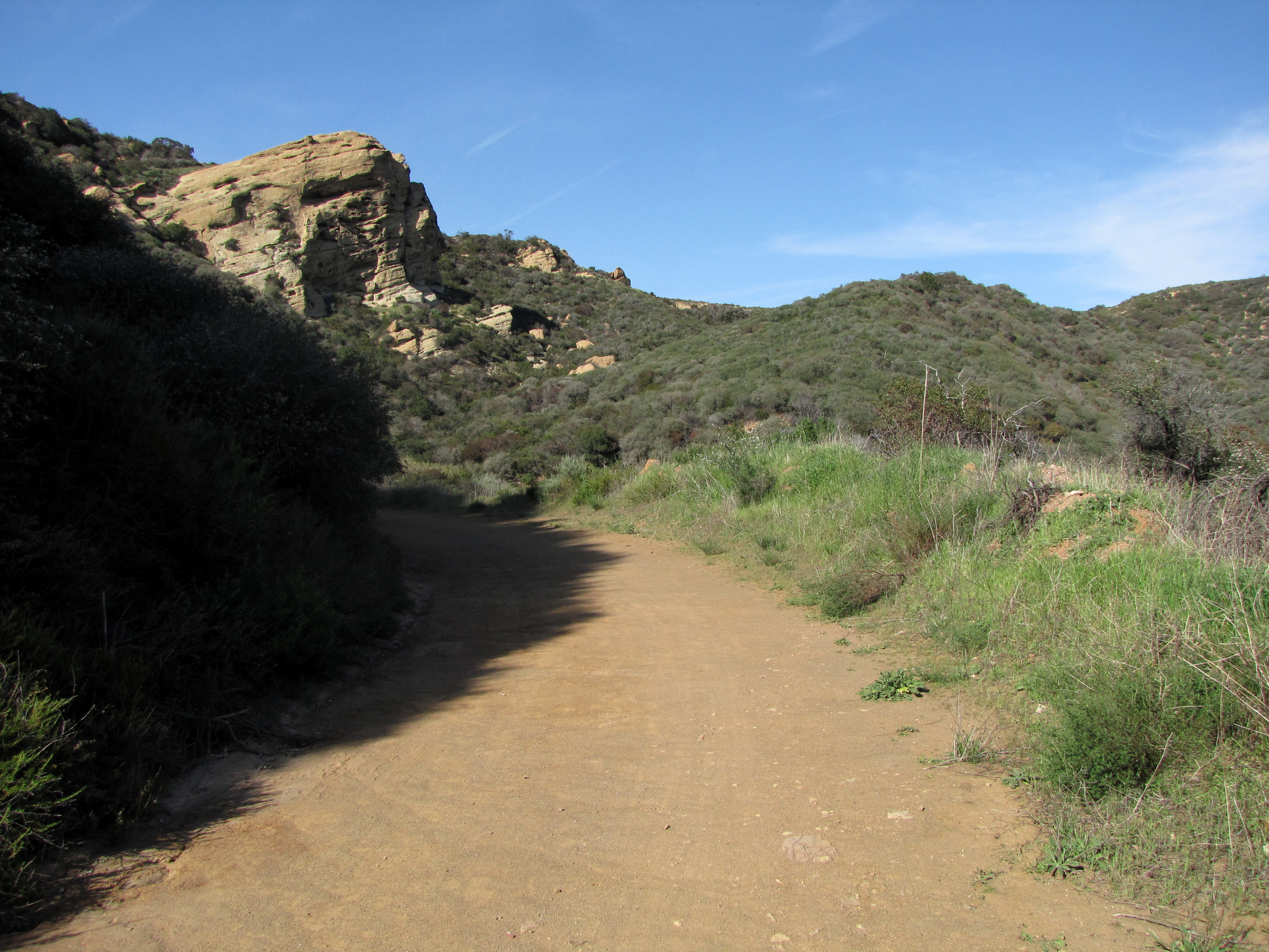
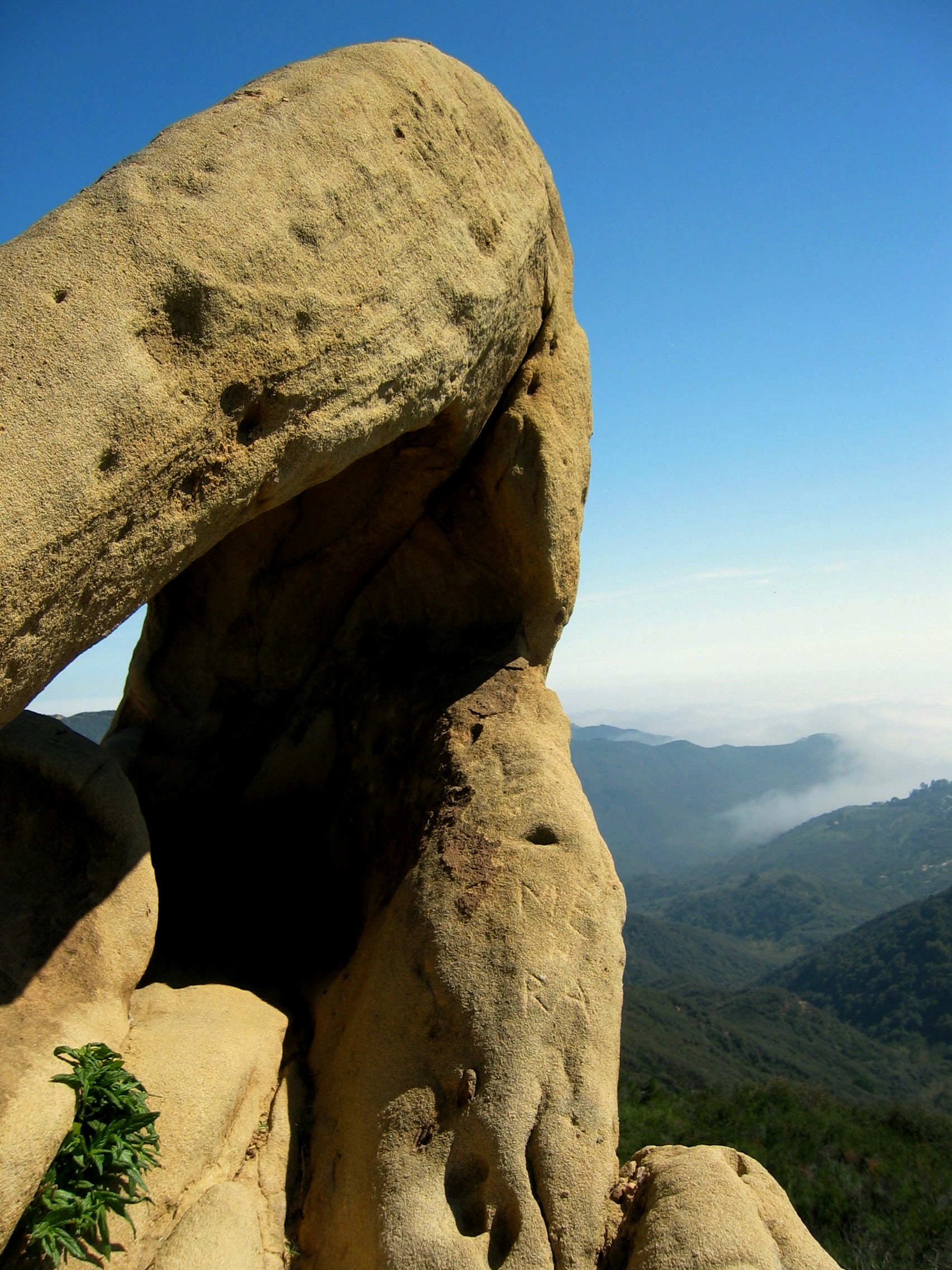
Back on the main path, the Backbone Trail soon meets a series of photo-worthy sandstone rock formations. It is here where the trail begins its steepest descent, losing 1,000 feet in a single mile! It levels out at a watershed of sorts. Wild berries grow in abundance where the trail descends again, this time a well-groomed series of switchbacks into ominous-sounding Dark Canyon. The trail crosses Piuma Road, winds through a grove of bay trees, crosses private property, and meets Piuma Road again, where it seemingly ends. Walk west along the shoulder and in less than five minutes you’ll see the traffic light at the intersection where Piuma Road meets Las Virgenes/Malibu Canyon Road. Total distance: 12.3 miles.
Day Three: This is a hard day of hiking, although it mostly lacks the route-finding, road-crossing challenges of Day Two. The Backbone Trail originally continued from yesterday’s end point by dropping below the vehicle bridge spanning Malibu Creek. The idea was to hike through the sandy bank and look for one particular area where large boulders made it possible to hop across the year-round creek, which really rages during years of heavy rainfall. The bank has eroded enough that this is no longer a viable option. Instead, the accepted route is to cross the busy road to a pedestrian lane on the west side of the bridge, or to simply park at the small Tapia lot for Malibu Creek State Park and start there.
The bike-friendly trail begins immediately past the restroom and climbs relentlessly from the first step. There is considerable shade for much of the way, and that’s about all that makes this ridiculous climb bearable. I remember hiking it after the El Niño rains of 2004-05. A gully of water eroded a ditch into the middle of the trail. House-sized boulders crashed onto the path. Fallen trees acted as frequent obstacles. And everything was so very, very green.
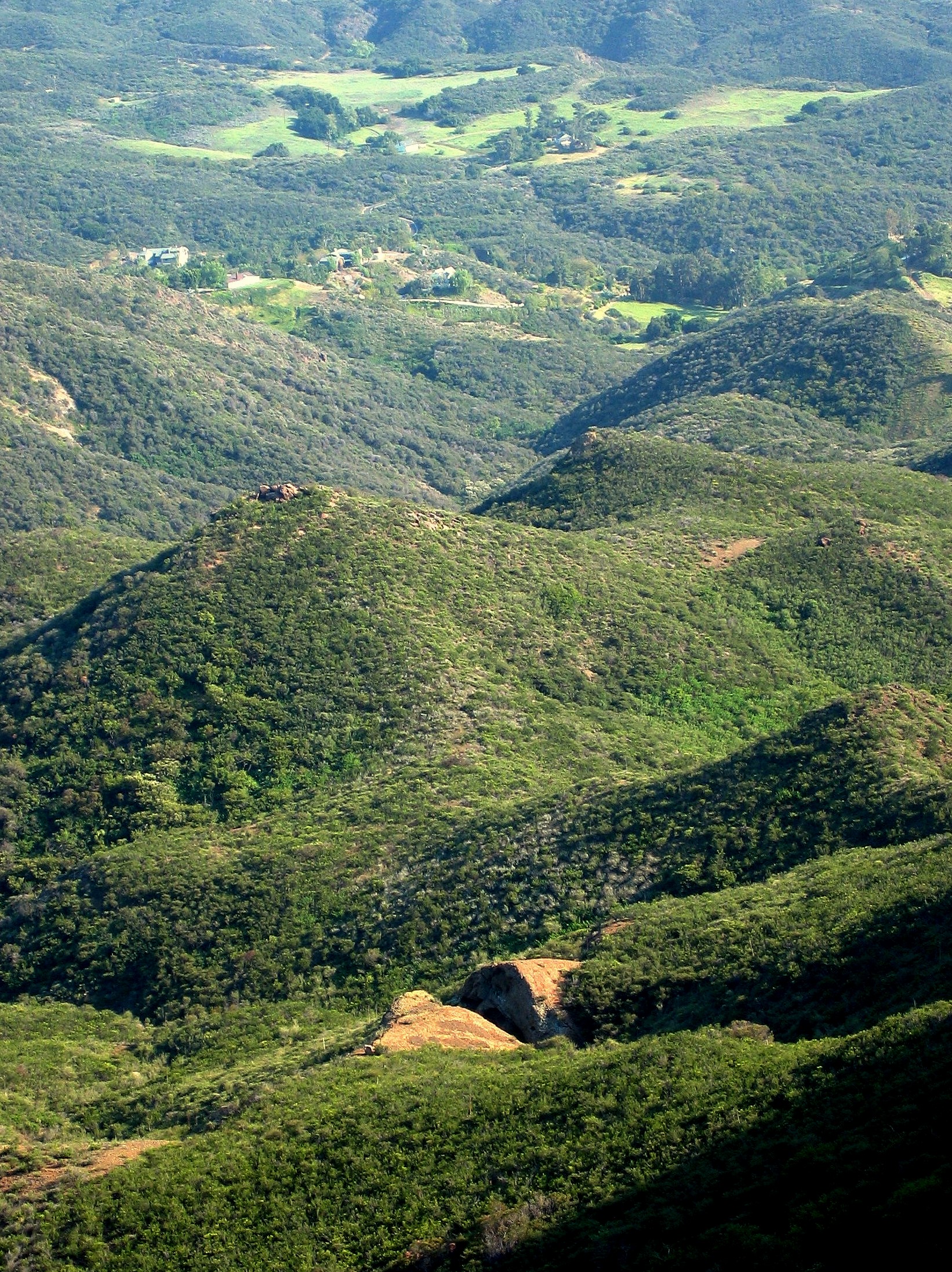
The trail eventually levels out. Looking left, you can see a stretch of Malibu Canyon Road as it winds through the canyon towards the Pacific Coast Highway. Ocean views are straight ahead. And spring wildflower displays are dazzling. The Backbone Trail forks right (west) before Mesa Peak and becomes known as the Mesa Peak Motorway. A series of gentle rises and minor hills eventually lead to a rock wonderland of sorts. The trail becomes an easy scramble over smooth slick rock. A rusty car lies abandoned in the brush on one side of the trail, while a rock arch on the other side seems like something you might find in, say, Utah. I encountered a mountain lion close to here once.
Day Three of the hike consists of three more sections. The first descends into upper Solstice Canyon, crossing Solstice Creek numerous times. This is a common mountain bike route, although I would imagine that the crossings make for a bumpy ride. A moderate climb out of the canyon and then you descend again, into Latigo Canyon this time. Repeat, cross remote Latigo Canyon Road, and enter Newton Canyon. You will hardly notice the easy climb out. The trail crosses a private driveway. You might hear motorcycles soon after; Kanan Dume Road is close. A tunnel for car traffic – one of three along the road – was blasted through the mountain, and the trail passes over the tunnel, before descending to a dedicated Backbone Trail parking area. Total distance: 11.9 miles.

Day Four: Each day is harder than the day before, and Day Four is no exception. The trail leaves the parking lot and enters an area of year-round verdant greenery that is Zuma Canyon. It passes above a small waterfall (no access), then crosses a footbridge. A second waterfall, Upper Zuma, can usually be seen in the distance, but requires off-trail scrambling in order to reach.
After 2.5 miles, this leg of the Backbone Trail meets a dirt fire road marked on maps as the Zuma Ridge Motorway. This is where it gets tricky. One section of the Backbone Trail – not even a mile in length – is on private property and is not open to the public. According to the National Park Service, the land is co-owned by two parties, and they cannot agree on terms that would allow the NPS to either purchase the land or agree to an easement. One of the co-owners? None other than California’s former “governator,” Arnold Schwarzenegger! So there’s your Hollywood gossip for the day.
To bypass this closed (at time of writing) section, take the fire road east (downhill). You will soon run into Encinal Canyon Road, rural but a common thoroughfare for motorcyclists. Carefully walk along the wide shoulder until a use trail appears on your left, through a yellow gate. This use trail climbs to the official continuation of the Backbone Trail. The trail almost immediately descends again, into pretty Trancas Canyon this time. A footbridge at the bottom marks one of the highlights. Climb out, cross Encinal Canyon Road, and look for the Backbone Trail marker on the other side of the grassy parking area. This trail, in turn, crosses Mulholland Highway near a ranch complete with white picket fence, and begins a steady – but really quiet pleasant – climb through a beautiful chaparral forest. The higher you climb, the better the view. Those giant radar dishes in the distance? They are part of the GTE Earthstation near Arroyo Sequit. This stretch of trail opened in 2008, and it is perfection.

Etz-Meloy Motorway traverses the ridge across this six-mile section of the mountain range. A few houses stand on either end of the road, but it is otherwise a dirt access road, like the aforementioned Temescal Ridge Fire Road and Zuma Ridge Motorways. The Backbone Trail continues along the western two-thirds of the motorway. Hikers are requested to proceed with caution as they pass the three or four residences that line a paved stretch of Etz-Meloy just before the motorway ends at Yerba Buena Road. Note that you’ll cross into Ventura County at some point along Etz-Meloy Motorway.

The trail continues on the other side of Yerba Buena Road, perhaps 50 yards south. In all my years of hiking the Backbone Trail, I have yet to encounter a sole on this easy four-mile leg. I will comment on the scenic features. Be watching for a split rock below the trail to your left (south). Ocean views are prevalent much of the way, and as the trail winds around Triunfo Peak, the ocean view gives way to a view of massive Boney Mountain and its acme, Sandstone Peak (you’ll tackle that behemoth of a mountain tomorrow). The trail enters a pretty valley and deposits you in a gravel parking lot that has no services – restroom, water, cellular, or otherwise – and that seems miles removed from the smog and traffic of Los Angeles, where your hike began three days ago! Total distance: 12.8 miles (estimated).
Day Five: Are you tired yet? The final day of hiking (if you use a car shuttle) will leave you both exhausted and exhilarated, often at the same time. Yerba Buena Road is perhaps the most remote – and most scenic – in the Santa Monica Mountains. The hike continues not as the Backbone Trail but, rather, as the Mishe Mokwa Trail. This narrow trail is open to hikers only. Despite – or maybe because of – that, it is one of the most popular hikes around. The lot is full on most Saturdays. We won’t hike the entire length of the Mishe Mokwa Trail, however. After just two-tenths of a mile, a “Sandstone Peak” trail forks to the left. Take this and after ten minutes you’ll meet a much wider, and steeper trail.
The wide Backbone Trail to Sandstone Peak is a merciless trail on a hot, sunny day. It takes few prisoners as it climbs over 1,000 feet to a high point of 3,000 feet, before descending slightly to a spur trail. This spur trail leads to the true high point of Sandstone Peak. Some scrambling is involved. The summit marker reads “Mount Allen,” in honor of a local Scoutmaster from days gone by, however that name never stuck. I love it here. Incidentally, despite the hue, the rock here is actually volcanic, not sandstone.

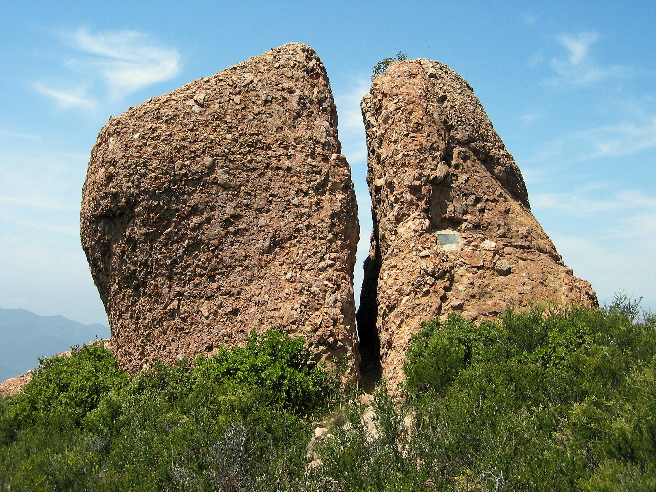
Sign the summit register, then carefully descend to the Backbone Trail. It winds along the flanks of the Boney massif, and Inspiration Point – the second of the hike – offers a vista point that many believe is even better than that found on the Sandstone Peak summit. You can access the opposite end of the aforementioned Mishe Mokwa Trail not far down the path from here, but we’re going west, not east. The Backbone Trail becomes the Chamberlain Trail and descends slowly, endlessly along a chaparral ridge. Chamberlain Rock comes into view, and it’s the second split rock we see in two days. (A third split rock can be found along the Mishe Mokwa Trail; I wonder what it is about the geology of this area that allows for such fissures to form. Besides earthquakes, I mean.)
A descent of nearly 3,000 vertical feet leads you through Blue Canyon, past a group campground, and along the wide, flat Sycamore Canyon Trail. This leg of the trail is popular with families on bikes. The colors change in late November, and parrots can occasionally be spotted in the trees. After a nice, level mile, the climb resumes one last time as you head west – and uphill – on the Wood Canyon Vista Trail. This multi-use trail is almost too narrow for mountain bikes, but they are allowed nonetheless. Hike with caution.
The Wood Canyon Vista Trail becomes the Overlook Trail, which essentially is another fire road, albeit one with views into the La Jolla Valley Natural Grassland. A pond exists on the edge of the grassland, and can be a great spot for watching ducks, although it has been dry these past few drought years. Chumash Indians lived in the area for centuries, and it is believed that some of the trails that exist here have been around for thousands of years. These fragile foot trails are not part of today’s hike, but I recommend coming back on a spring day to experience the sound of the wind blowing through the grass. There quite simply is nothing like it on earth.
The Overlook Trail leads to the Ray Miller Trail after two miles. This trail, in turn, descends 2.7 miles to the bottom of La Jolla Canyon and the end of our hike. Take your time and savor the stunning view as your descend. You will pass a group campground just before reaching the parking area, part of Point Mugu State Park. Beach access is just across the PCH. Total distance: 16.1 miles.

The Future of the Backbone Trail
There was a dream, for decades, to build an east-west trail that crossed this transverse mountain range from Griffith Park to Point Mugu. Alas, urban development has pushed the trail’s start considerably west of the 405 Freeway, but it finally exists in some form. It was just 75% complete when I first discovered it in 2001. Today, it is 98% complete! I believe in the National Park Service. I believe that they will successfully negotiate purchase of the missing acres necessary to complete the trail. Once that is finished, they will construct more walk-in campgrounds. I am told that the money is there, and I respect that NPS is trying to do things in the right order.

Now go take a hike, Loyal Reader!
