I have mentioned more than once in this blog that September is one of the best months for hiking. My Mount Kilimanjaro hike, in 2010, is just one example of successful multi-day, late summer/early fall hiking. I can hardly fathom the thought that it has been exactly 11 years ago this month since I hiked the Inca Trail through the Peruvian Andes to the pre-Colombian citadel of Machu Picchu.

Two Weeks in Peru
Two weeks is nowhere near enough time to enjoy everything that Peru has to offer. But my vacation time was at a premium in 2005, so I had to pick-and-choose my itinerary from an impressive and lengthy Peru highlights list. The fact that my friends Miles and Chuck were tagging along made itinerary planning even more difficult.
After much deliberation, we finally decided on Lima, Cuzco, the Inca Trail, Machu Picchu, Aguas Calientes, and (via La Paz, Bolivia) the Bolivian and Peruvian sides of Lake Titicaca, the world’s highest navigable lake. Miles and Chuck had a few extra vacation days and added a four-night Amazon River cruise to their trip. Totes jealous, was I.
We initially decided on a September trip not only so that we could wrap the trip around Labor Day weekend, thereby using less vacation time, but also because optimal weather conditions for the hike are said to be between the months of July and September. A hike in April, say, would be a muddy affair indeed…and that’s assuming that the trail would even be open during the rainiest of months for the region.
Online trip planning revealed that it is compulsory to hire a guide and hike with an organized group. Although most trekking companies (all of them based in Cuzco, Peru) offer the same experience, some of them offer warmer sleeping bags, more knowledgeable guides, and – perhaps most importantly – better treatment of porters than other companies. Miles and I decided on Peru Treks while Chuck, who booked late and couldn’t find a spot in our group, went with United Mice instead.
I recall paying roughly $600 for my four-day, three-night Inca Trail experience, and current website prices for 2016 and 2017 quote $625-650. As such, it appears that rates are still reasonable, considering that these prices include transportation from the hotel to the trailhead, train travel back to Cuzco, and guide and porter service, as well as tent, sleeping bag, and Machu Picchu admission. Want a thermal sleeping bag? The price goes up. Wish to hire a porter to carry your pack? The price goes up. Prefer to ride back to Cuzco in the glass-roofed VistaDome train? The price goes up. Et cetera.
Touchdown in Peru
Lima, the capital and transportation hub of Peru, is one of the fastest-growing cities in Latin America. Unlike highland Peru, where the weather is sunny and dry all summer long, Lima is often damp and fogged in, its perennial coastal garúa (thermal inversion) lending the city a sort of “June Gloom” feel for those of you who live in Los Angeles and get the climate reference.
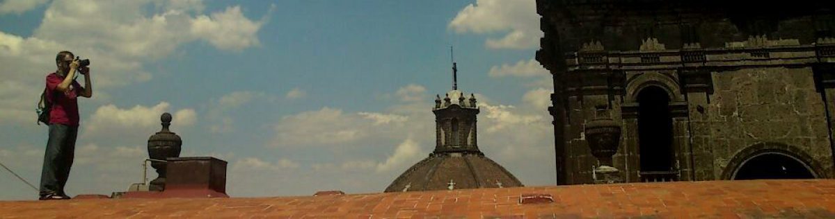
For reasons I don’t fully understand, most of Lima’s long-haul international flights arrive around midnight. Most tourists to Peru merely pass through Lima; those who do usually stay in the lively and upscale Miraflores district, although Lima’s Centro Histórico, with its cathedral (pictured below) and Plaza Mayor, merits a full day’s worth of sightseeing.

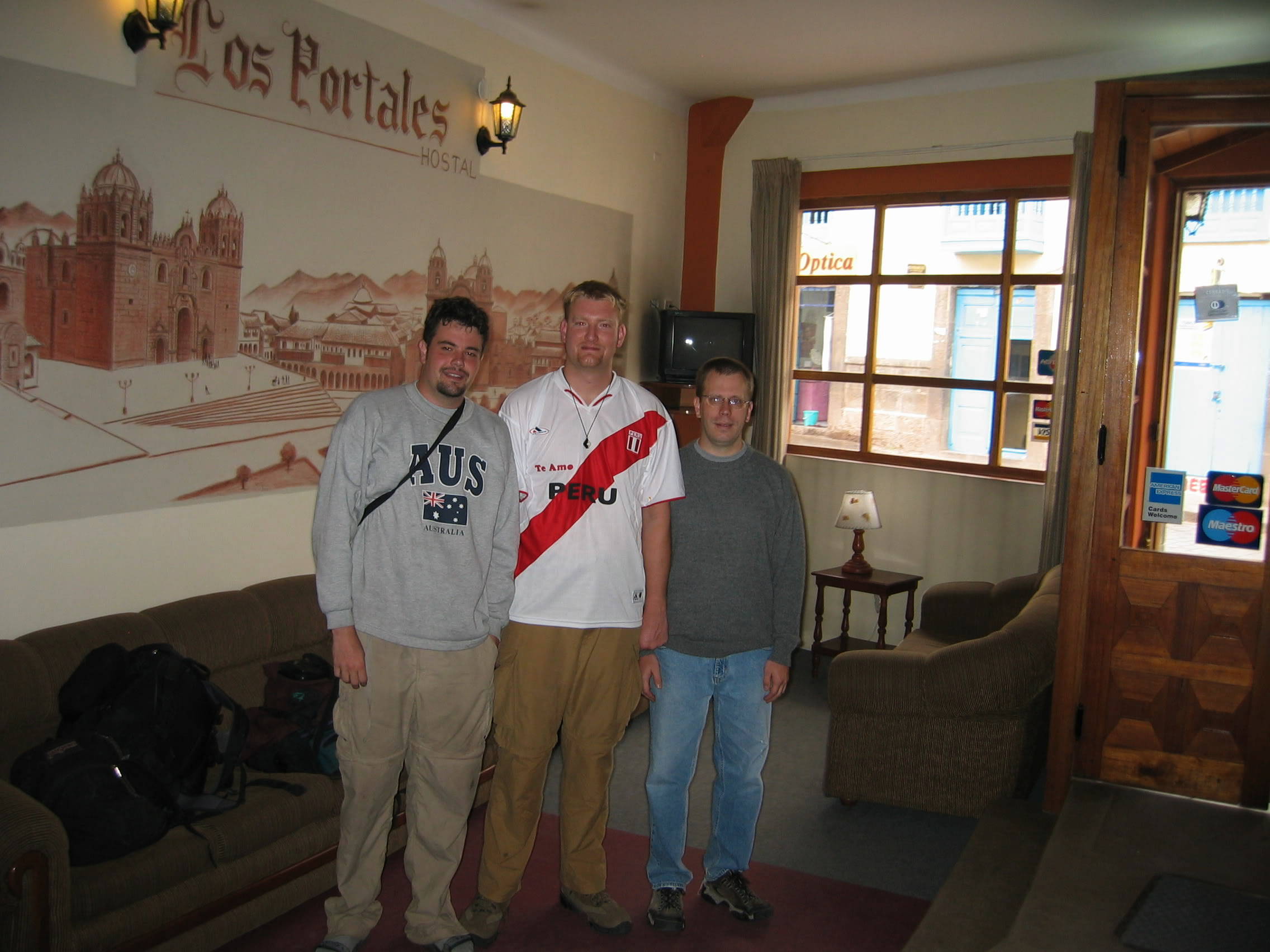
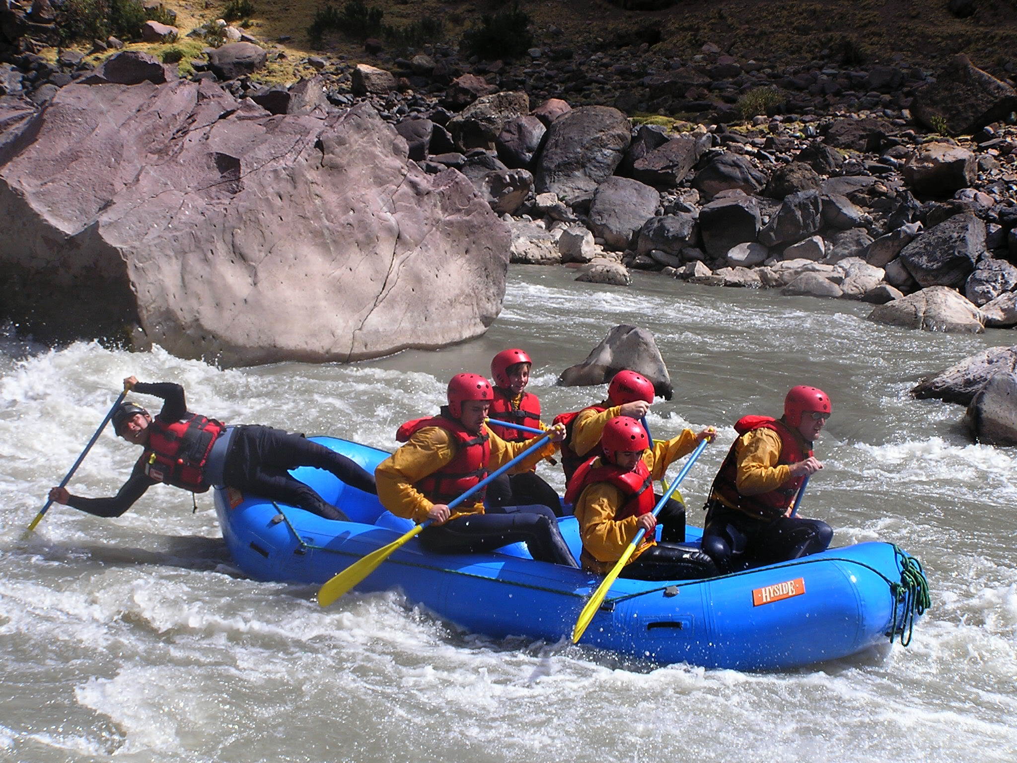
We spent two days in Lima and then continued by plane (LanPeru) to Cuzco, 19 hours by bus but just one hour by plane. Our three days in the high-altitude city of red roofs, Inca walls, and crisp, clear air were packed with things to do. In addition to a pre-hike debriefing, we also went rafting on the Upper Urubamba River and shopping at the nearby Pisac Market. Our first order of business, however, was to buy an alpaca sweater to combat the cold morning air.
Inca Trail Day One
As these things so often go, our wake-up for the first day of hiking came way too early. Chuck, whose trekking company picked him up in a different van, had an even earlier wake-up. We climbed, bleary-eyed, into a van and drove for nearly two hours into the Sacred Valley, which was surrounded by forbidding, snow-capped Andean peaks taller than any mountain in the contiguous United States. We stopped in the gateway town of Ollantaytambo, where hikers had the opportunity to purchase trekking poles and bottled water. The town’s main square was filled with dozens, perhaps hundreds, of able-bodied men and women hoping to gain passage – and money – as a porter.
From Ollantaytambo, it was just another 10 or 15 minutes to the trailhead – a suspension bridge spanning the Urubamba River, near KM 82 of the Cuzco-Aguas Calientes railway. Starting elevation of the hike was roughly 2,774 meters (9,100 feet).

One of the attractions of hiking the Inca Trail to Machu Picchu as opposed to simply taking train directly from Cuzco is the ability to see lesser Inca ruins along the way. No one really knows when Machu Picchu was built, nor what it was used for, but the generally-accepted theory is that it was the ruling city for a once-great Inca empire that stretched from Ecuador to Bolivia. If you take that theory into perspective, the “progression” of ruins that hikers pass en route to Machu Picchu makes more historic sense.
The trail was mostly level, with one major hill. (“He lied,” Miles bemoaned upon approaching the hill and in response to our guide Manuel’s promise that there weren’t any hills on Day One.) The plateau atop that first hill looked down upon the most impressive ruin of that first day, Llactapata. A small, mud-brick temple appears to be the only significant, surviving structure on the lower terraces, sloping upwards from the river, but the series of upper terraces are rather striking.

It wasn’t long after passing Llactapata that we stopped for lunch. Meals were one of the trek highlights, and there was always plenty to eat. Have you ever eaten alpaca? Trust me, it’s delicious, and it showed up on the menu at least once each day, along with all of the rice and coca tea a person could stomach. Other delicacies: grilled chicken, Lake Titicaca trout (sublime), purple corn juice, and papas a la Huancaína (boiled potatoes covered in a spicy yellow sauce).
From time to time, as we continued our hike to the first evening’s campsite, someone would shout “Porter on your left!” and a well-toned Peruvian porter, eternally tanned and boasting pronounced ethnic features, would scurry past, carrying backpacks, crates of eggs, sacks of flour, even cooking stoves on his or her back! Most porters wore sandals, the soles worn thin. For those hikers who complained about the conditions: in comparison to the porters, we had it easy.
A gentle uphill climb led us to our campsite, just as the sun set behind the mountains (it gets dark quickly in the Andes – usually around 6 p.m.). A few corrugated metal shacks surrounded the primitive campsite – little more than tents pitched in a sloped, grassy field with chickens running amok. A canvas tarp pitched over collapsible poles served as our dining room, where we shared stories from the day while drinking liberal amounts of coca tea, mostly to stay warm.

Inca Trail Day Two
We went to bed and woke up at roughly 10,000 feet (3,048 meters) above sea level. It was cold! Breakfast – tea and coffee, pancakes and eggs – was a welcome way to start the day, although I knew that the carbs, while needed, would also lead to bloating and slow going on the trail, which was almost 4,000 vertical feet of elevation gain, all the way to the dread-sounding Dead Woman’s Pass.
We set off following a post-breakfast debriefing, and I was amazed to see locals (living in one of those corrugated metal shacks, most likely) selling soft drinks and bottles of Cusqueña (the local firewater) to any passersby who wanted to take on the extra weight.

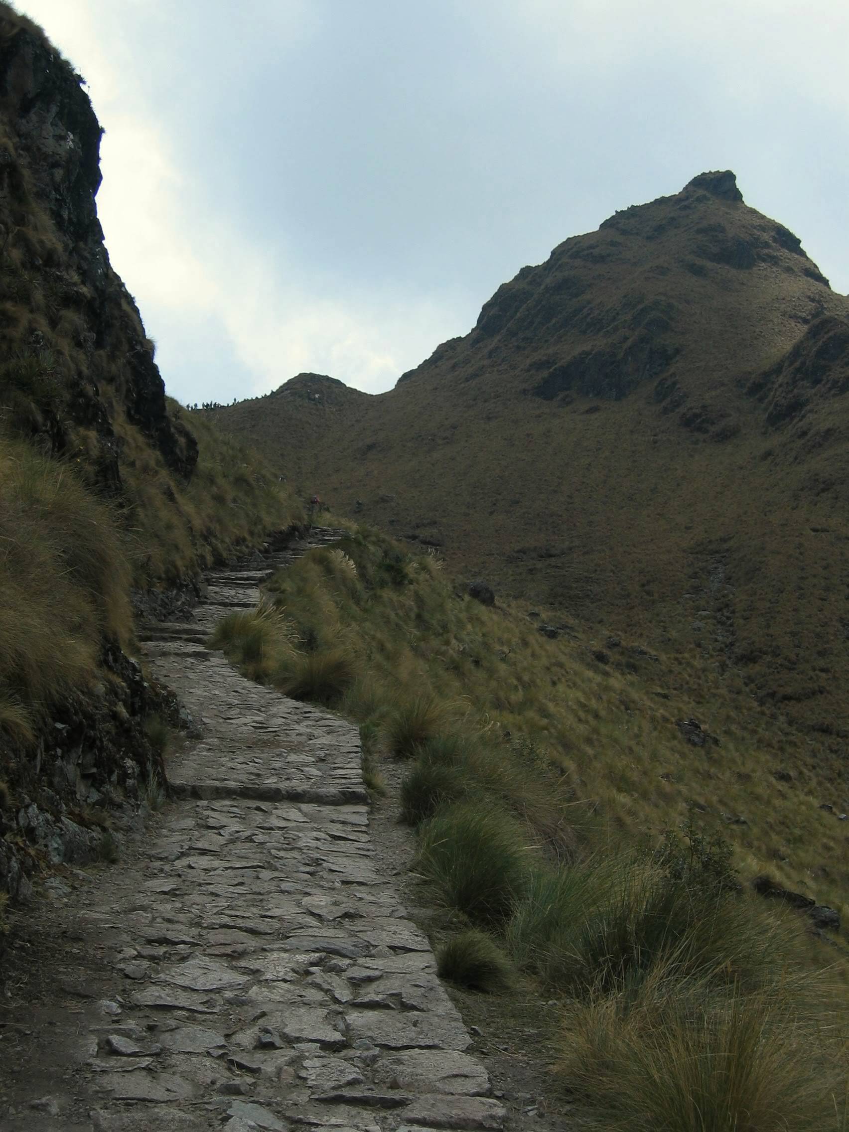
True to its reputation, the trail was no-nonsense, uphill all the way. A gentle waterfall flowed alongside the trail for some distance, and several surrounding peaks had year-round snow patches – usually in shadowy recesses that never received direct sunlight. As I climbed ever higher, I munched on coca leaves that I had purchased in Cuzco two days earlier. Resin secreted from the leaves kept altitude headaches at bay, although fatigue was still an issue.
We were informed during our morning briefing that lunch would not be served until we reached the second campsite, so it was something of a welcome surprise when our assistant guide beckoned us off trail to a clearing, perhaps 800 vertical feet from the top, for a snack break of popcorn and chica morada (the aforementioned purple corn juice)! Miles, who had lagged behind for much of the day, spent the break napping in the sun, hat cocked over his face.
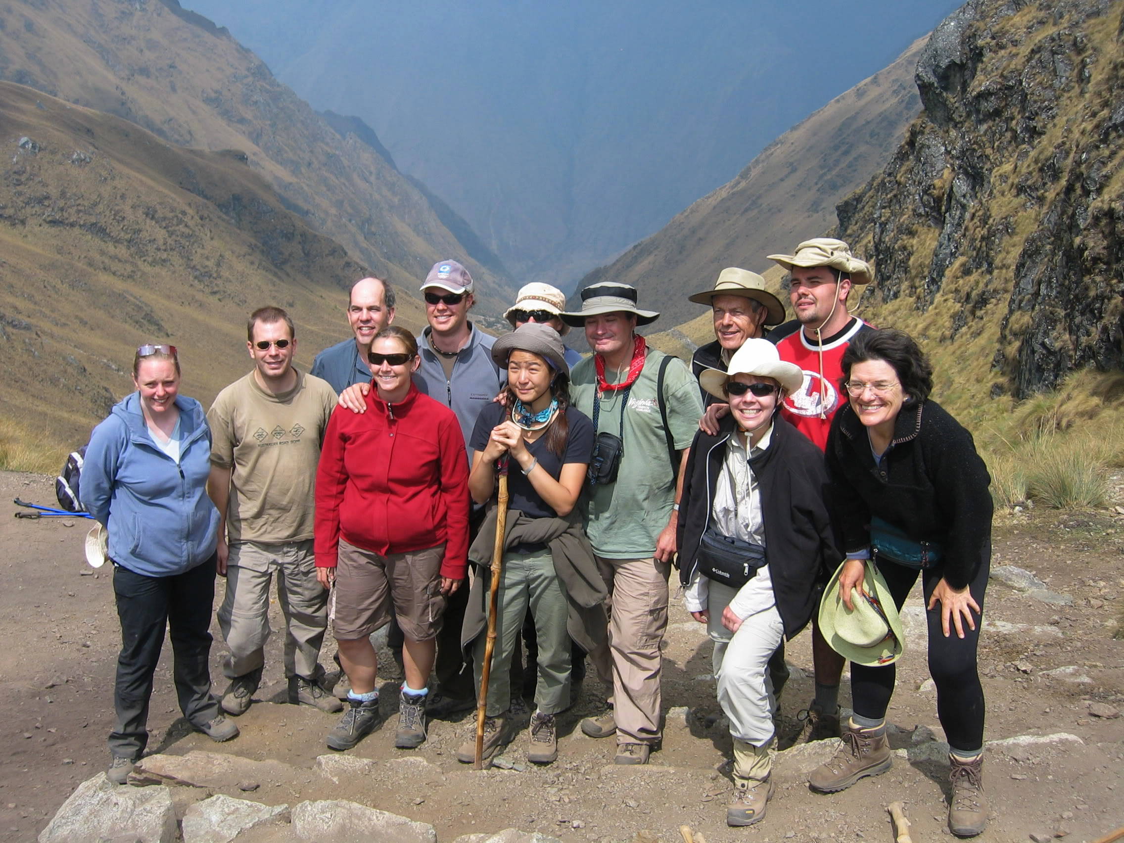
I don’t remember the names of my fellow hikers, but while I would normally consider myself a fit, fast hiker, several of them – backpackers who had already spent six weeks in and around Peru, and who were acclimatized to the region’s high altitude – left the rest of us in the dust. By the time we reaches Dead Woman’s Pass for a group photo, the fastest among us were already on their way down.
Four-thousand, two-hundred fifteen meters. Thirteen-thousand, eight-hundred twenty-eight feet. That is the precise elevation of Dead Woman’s Pass, the literal, if not figurative, high point of the Inca Trail. The wind howled and the clouds swirled overhead, fog shrouding the tallest peaks. But it was all downhill from here (for the remainder of Day Two, that is), and the “worst” was behind us.
The descent went without incident, and it wasn’t long before we arrived at the second campsite, which was large enough to accommodate all of the trekking groups. Somewhat strangely, we had a large lunch and an even larger dinner just two hours later. I can’t speak for everyone else, but I passed those two in-between hours by taking a well-deserved nap.
Despite the higher altitude, it was warm enough to sleep comfortably. The overhanging clouds trapped in whatever warmth remained from the afternoon sun. For those of you who are wondering, the toilet facilities left much to be desired. This may have since changed, but I doubt it. If there is one universal truth about campgrounds, it is that their restroom facilities are always found wanting.
Inca Trail Day Three
Day Three was overcast, but the hike itself was filled with points of interest. We were allowed to sleep in, and were informed during our post-breakfast briefing that the last significant uphill stretch of trail would be followed by a much longer section of downhill hiking that brought hikers closer to Machu Picchu’s elevation of 2,720 meters (7,972 feet).
The uphill climb passed three Inca ruins of note: Conchamarca, Runkur, and, at the highest point of the day’s journey, Sayacmarca. Perhaps my favorite image from that day is this one, below, of Conchamarca, seen from a lookout at Sayacmarca. The clouds, along with the framing, make the picture.
I remember seeing an elderly British gent at several points along the trail. He had hired a private guide for his Inca Trail experience, and seemed a real fish out of water with his fanny pack, gaiters, and red baseball cap. The last time I saw him was at Sayacmarca, where his pants were torn and his cheek was cut up pretty badly from an apparent tumble somewhere along the way. He earned the “spirit” award in my book for always having a smile on his face. Indeed, when I saw him at these ruins, bruised up, he seemed never the worse for wear, and happier at that moment than most people appear on their wedding days. Remarkable.
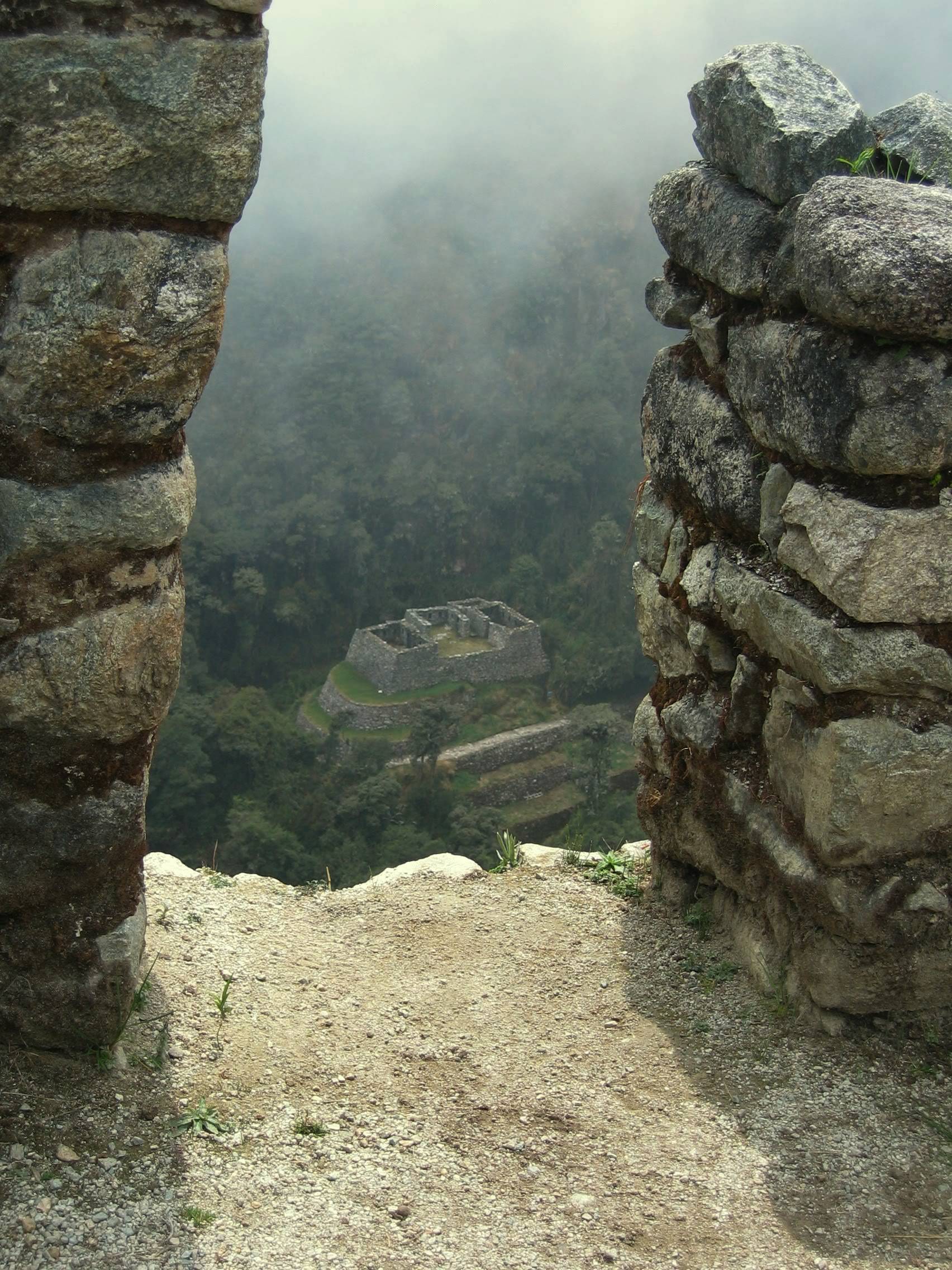
Even more remarkable was the downhill hike from Sayacmarca to the fourth ruin of the day, Phuyup. The Phuyup complex featured clear examples of Inca irrigation, and the hike to the ruin passed mossy rocks covered in lichen, and even dipped into a couple of natural rock tunnels.

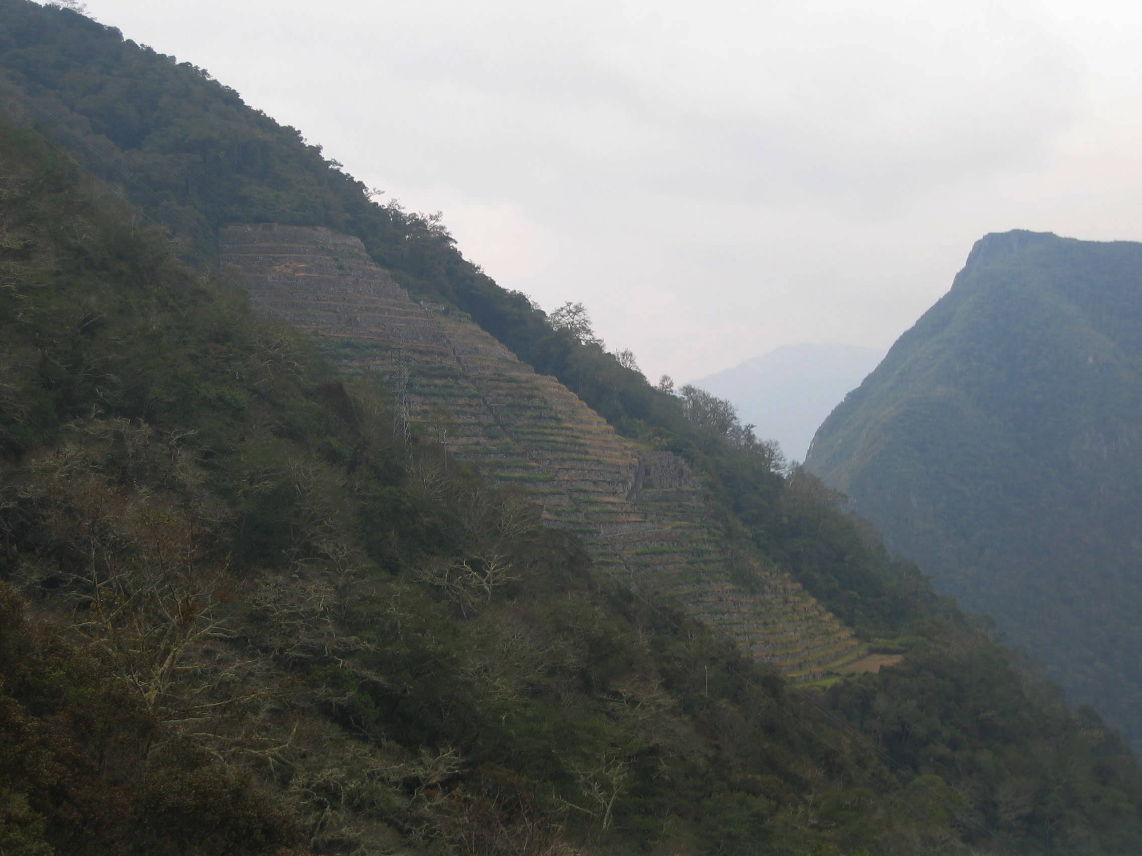
Two-thirds of the way down the trail, a fork gives hikers the option of taking an alternate route to the third campsite. This alternate route passes Winay Wayn, a small, terraced ruin perched along a steep hillside. I photographed Winay Wayn from afar, but, being a purist, stayed on the original Inca Trail for the final, dusty descent. By the time I arrived at the third campsite, my knees were pounding.
Inca Trail Day Four
Our last day of hiking was almost an afterthought; the hike itself was just one mile in length, and began while it was still dark. A short walk from the third campsite led us up some steep rock steps to the Sun Gate – the first vantage point of Machu Picchu for Inca Trail hikers. Our group had planned on being the first to arrive at the Sun Gate, but we got off to a later start than planned; two of the people among us became violently ill in the middle of the night.
The view of Machu Picchu from the Sun Gate is set at an awkward angle. Also in view: the unpaved road from the entrance gate that leads down to the village of Aguas Calientes below, via a series of dusty switchbacks. Guide Manuel paid close attention to our two nauseous hikers while assistant guide Andrés shepherded the rest of us to the Watchtower – a sort of “guard hut” that marks the Inca Trail entrance to Machu Picchu itself.

Funny enough, the real guardians of Machu Picchu weren’t ticket takers or tourist police, but llamas! These magnificent, buck-toothed beasts basically took over the final 20 meters of the Inca Trail. When asked later about the llamas, Manuel told us that a few of them wandered into the ruins from the village below one day a few years prior, and the tourists loved them so much that park rangers kept them on site, feeding them all the corn they could eat!

The Peru Trek hikers gathered for a group portrait, then moved to a quiet courtyard for a history lesson about the site from Manuel. Afterwards, the ill hikers were shuttled to a medical clinic in Aguas Calientes, 1,300 vertical feet below. I never saw them again.
Machu Picchu
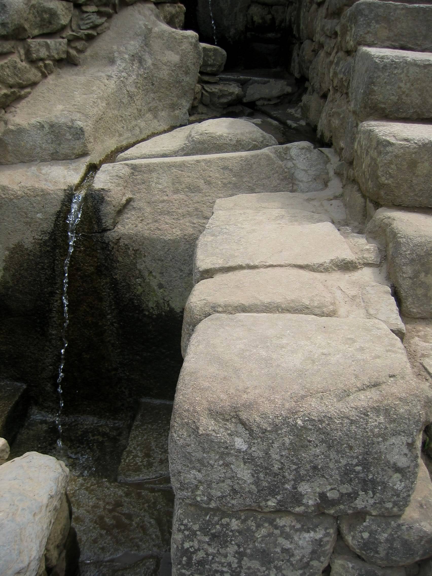
Machu Picchu is a marvel of Inca engineering. Its terraces seem to defy gravity, and its stones are fitted together without an ounce of mortar, yet you couldn’t even fit the blade of a knife between the stones! A complex irrigation system channels water from the Watch Tower to the lower reaches of the site. The site’s many courtyards absorb crowds nicely…and the statuesque peak of Huayna Picchu, with its own set of ruins, stands silent watch over the proceedings below.
Hiram Bingham, an American explorer and academic, discovered Machu Picchu in 1911. It is said that he heard rumors of a lost Andean city and commissioned indigenous guides to take him there. The Machu Picchu of today barely resembles the Machu Picchu he first discovered. The ruins are blessedly free from gaudy hotels and trinket shops, but their grasses are kept in pristine condition. I can hardly imagine what Bingham must have thought when he first bushwhacked his way through overgrowth to see those abandoned stone walls, lost in time.
Tips for Your Visit
The aforementioned Peru Treks and United Mice websites have lots of helpful information about trip costs, weather, and packing essentials. But I would add the following suggestions:
- Book your trek early. Machu Picchu features prominently on UNESCO’s list of endangered world heritage sites, so its daily permit system is strictly enforced.
- Spend a night in Aguas Calientes. Many hikers take the train back to Cuzco on the same day as their arrival at Machu Picchu, giving them limited time to explore the ruins on their own. Additionally, Aguas Calientes is an enchanting place, and the hot springs that give the town its name are open late into the night and make a great place to submerge your weary, post-hike bones.
- Spend at least three days in Cuzco before beginning your hike. Cuzco has much of touristic and photographic interest for the hearty traveler. Furthermore, the city resides at higher elevation than that of Machu Picchu itself, which makes acclimatization easier.
- Climb to Huayna Picchu. Spelled “Wayna Pikchu” in Quechua, the striking rock formation behind Machu Picchu is a worthy destination in itself. Although I found views from the top looking down at Machu Picchu, 360 meters (1,181 feet) below, to be oddly anti-climactic, the climb had me clinging to ropes, crawling through a small cave, and scrambling down a steep rock slope. Check your vertigo at the door.

Are you ready? Go take a hike!

Thanks for that very interesting post which took me back to my trip to Machu Picchu way back in the 1980s. I did not do the Inca Trail. I did however climb Huayna Picchu (scary!), and I hiked a small section of the trail for a fantastic “travel poster” panorama of the ruins. Back then Aguas Calientes had no hotels or restaurants at all. The only overnight accommodation was a small government-run hotel next to the ruins. The vast majority of tourists did the ruins as a day excursion, heading back to Cuzco on the train the same afternoon. I was lucky enough to stay at the hotel. The next morning the ruins were covered in fog, but as I stood at the Intiwatana (the Hitching Post of the Sun) I watched as the fog slowly broke to reveal a breathtaking vista of the snowcapped Andean peaks. Absolutely the most beautiful place I have ever visited!
I took the bus back up to the ruins at 6 a.m. the next morning for a second look, and experienced that same, low-hanging fog. Ethereal and otherworldly.
Thanks for sharing your experience, William.